Operational Insights from the Toulouse Weather Radar
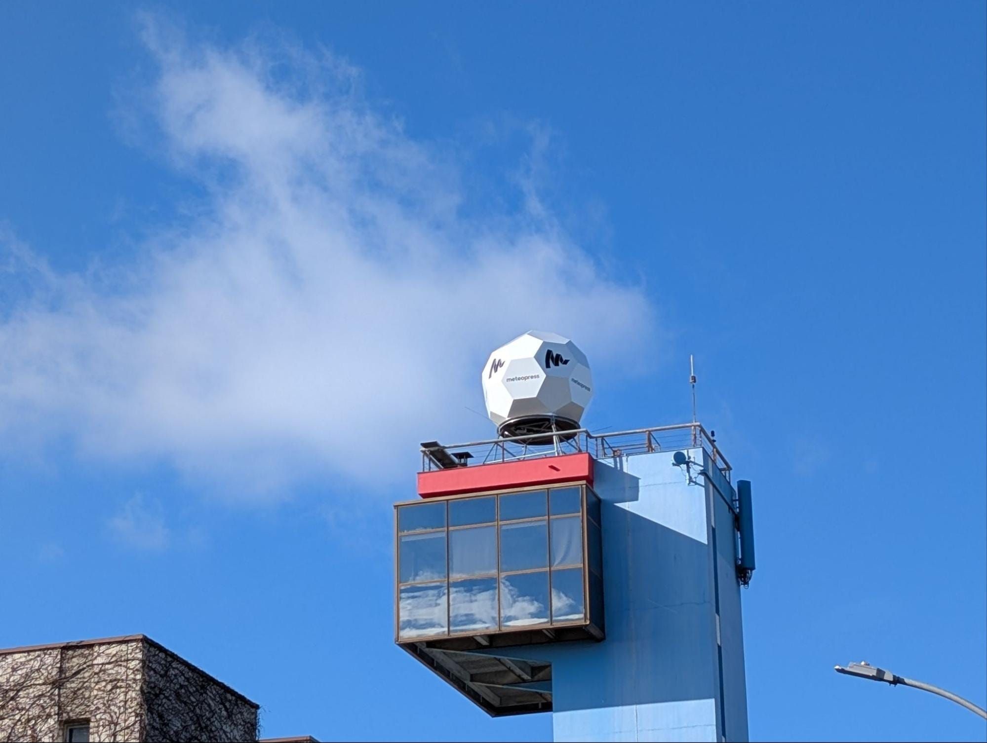
Radar: Meteopress Solid-state C-band
Antenna: 2.4 m / 1.7° beam width
Power: 10 kW, Solid-state
Location: Toulouse Airport
Operated by: MeteoFrance International
Installation: 24th January 2025
Installed at the end of January 2025, the new weather radar near Toulouse improves weather surveillance across southern France. Located in an area frequently affected by a mix of Atlantic disturbances, convective systems, and orographic influences from the Pyrenees, the radar is well-positioned to improve monitoring of diverse and often high-impact weather phenomena.
Once operational, the radar quickly began providing valuable high-resolution data, offering new insights into precipitation structures, storm evolution, and regional-scale weather dynamics.
This article highlights several of the first noteworthy weather events captured by the radar.
The radar was installed in Toulouse for a period of six months, with the purpose of allowing Météo-France to test a solid-state radar alongside their existing magnetron radar for a direct comparison. As a result of this trial, Météo-France subsequently published a white paper study, which concluded that “as a summary, Meteopress C-band radar is compatible with Météo-France general requirements and standards.”
Storms in southern France
During the warm season, particularly from late spring to early autumn, the area around Toulouse often experiences stormy weather patterns. These storms are typically convective in nature, forming when warm air rises and meets cooler upper air layers, creating instability in the atmosphere. The heat of summer days, especially when temperatures exceed 30°C (86°F), can fuel these conditions, making late afternoon and evening storms relatively common.
Thunderstorms near Toulouse can be intense but usually short-lived. They often bring heavy rainfall, frequent lightning, strong gusts of wind, and occasionally hail. The hilly terrain and nearby Pyrenees Mountains can also influence storm development by enhancing air movement and contributing to localized storm formation. While not as severe or prolonged as those seen in some other parts of Europe, these storms can cause flash flooding in urban areas.
Data samples
Case study - 19th May 2025
On 19th May 2025, southern France, especially southern Occitanie region, was hit by severe thunderstorms, including several supercells. These supercells produced large hail, in some cases up to 7 cm in diameter, and intense wind gusts.
Some thunderstorms had been occurring in the region since the previous night, but these were not particularly severe.
The first severe storm, which later evolved into a supercell, developed near Saint - Gaudens between 11:00 and 11:30 UTC.
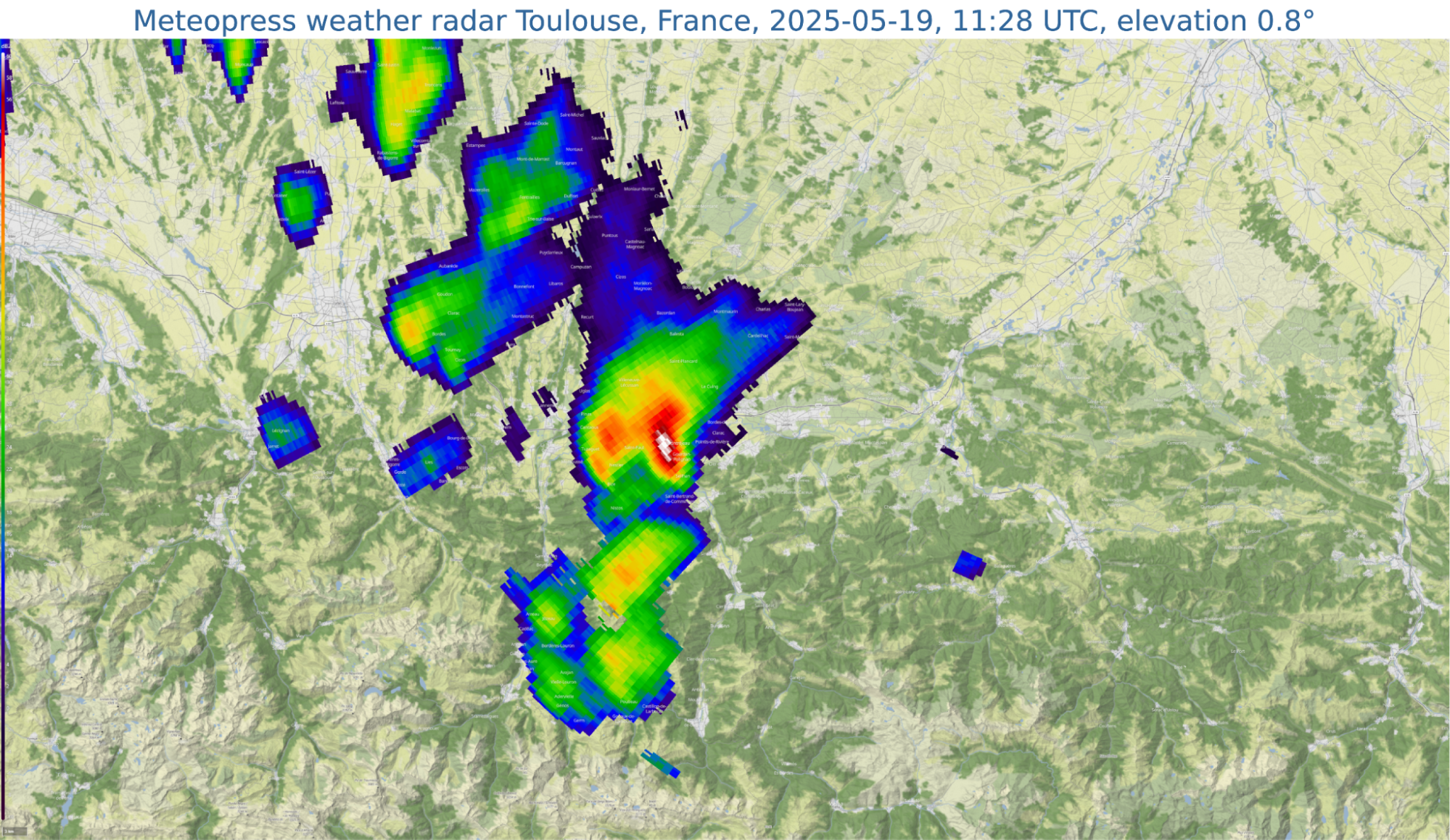
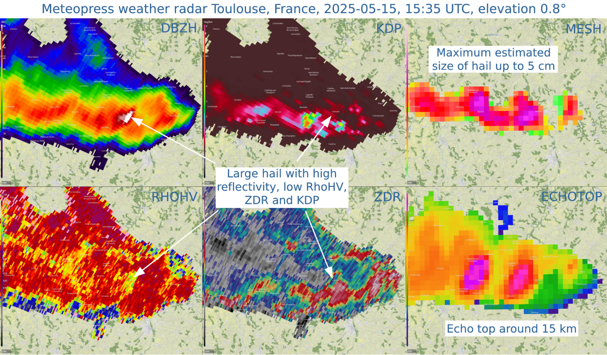
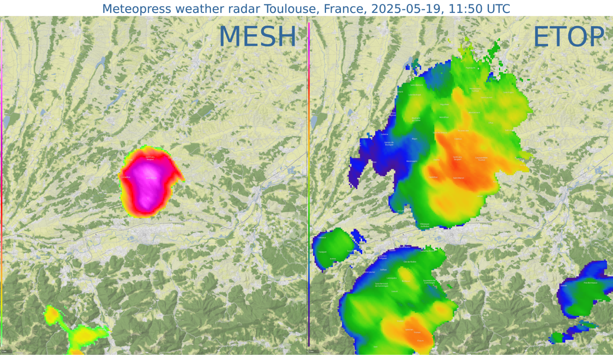
This thunderstorm quickly developed a mesocyclone and continued its journey to the northeast. By that time, the supercell was already producing large hail, which, according to the Maximum Estimated Size of Hail (MESH) product, reached up to 5 cm in diameter.
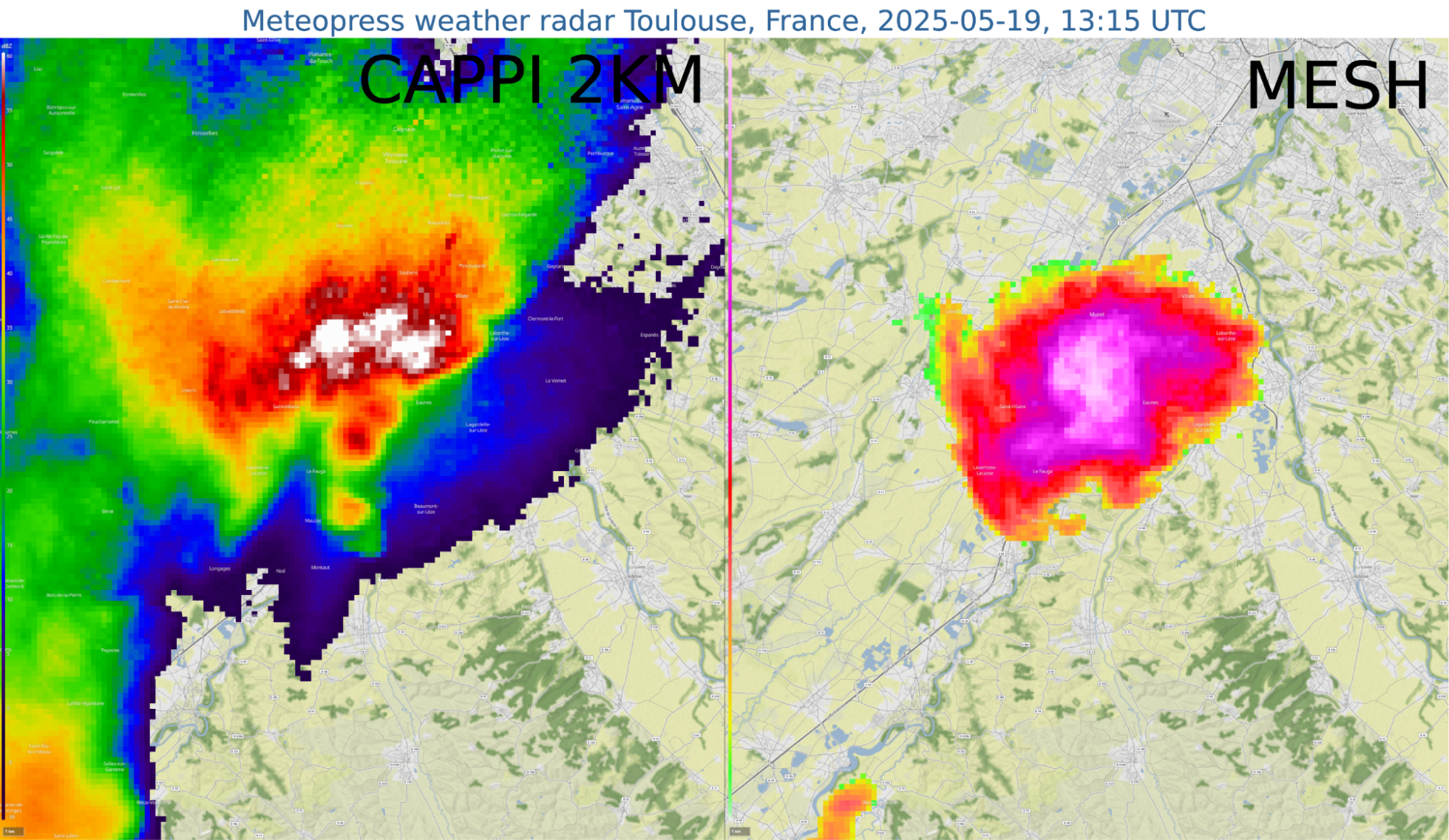
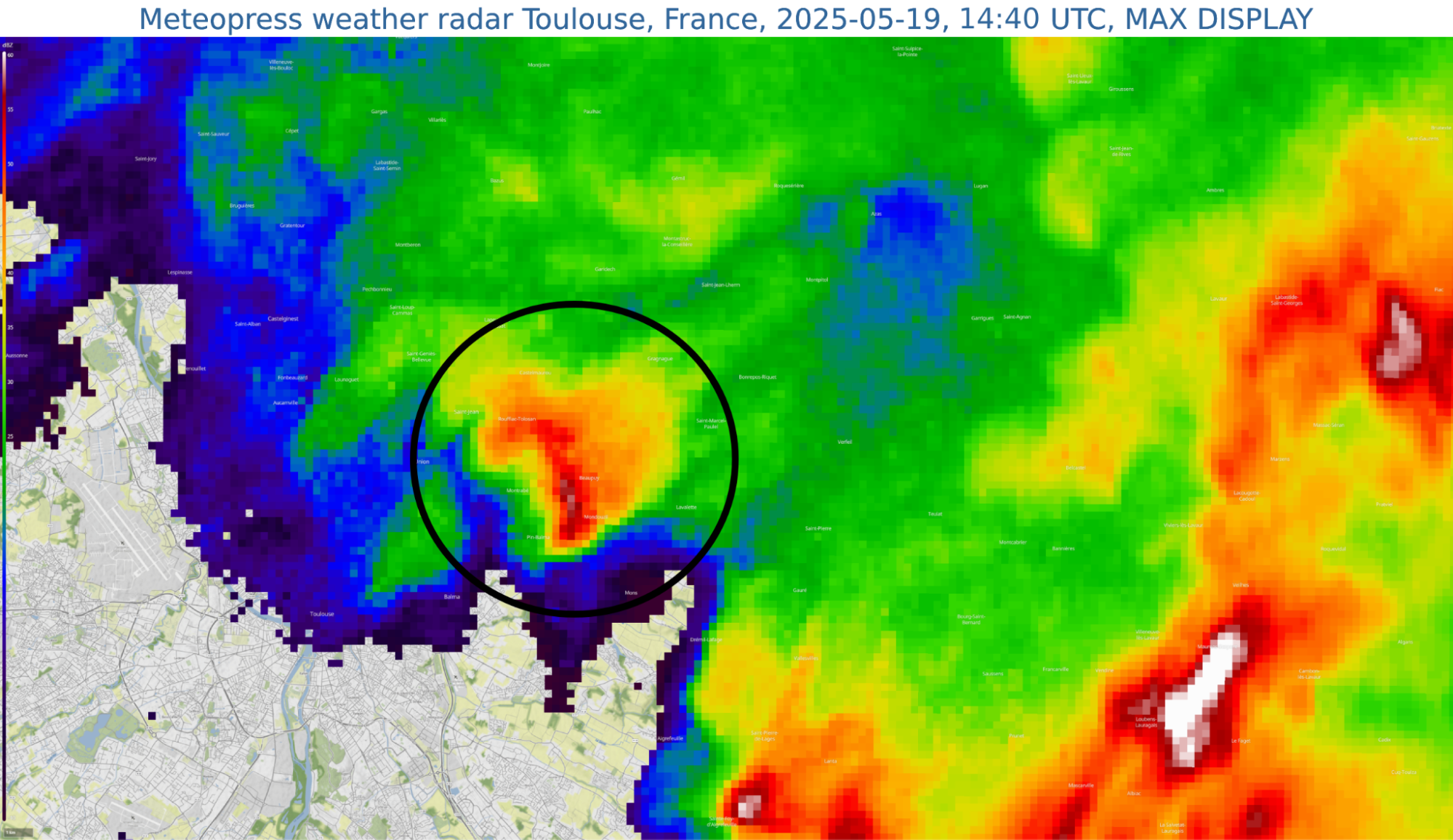
The supercell continued moving northeast and, between 13:00 and 14:30 UTC, affected the southern suburbs of Toulouse and neighboring towns, where intense downbursts accompanied by large hail were reported. In some locations, hailstones exceeded 5 cm in diameter. The supercell dissipated after 14:30 UTC, northeast of Toulouse.
Meanwhile, around 13:30 UTC, another supercell developed approximately 35 km south of Toulouse. It moved northeast and, according to the MESH product, initially produced hail up to 5 cm in diameter.
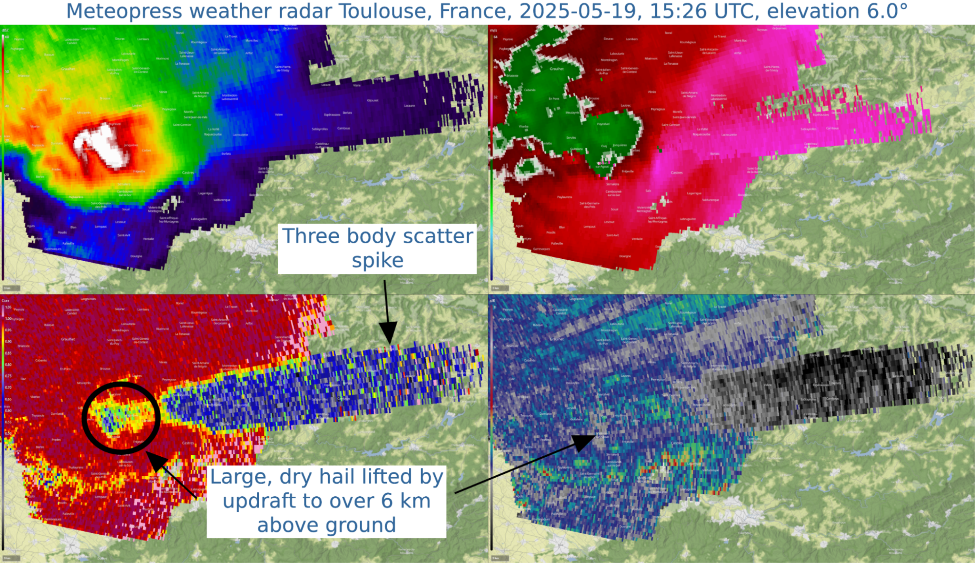
The supercell reached peak intensity between 15:00 and 16:00 UTC, with MESH estimates indicating hail approaching 8 cm in diameter.
Radar data after 15:00 UTC showed signatures consistent with large, dry hail being lifted by a strong updraft to altitudes of up to 10 kilometers above ground level. A three-body scatter spike (hail spike) was also observed during this phase.
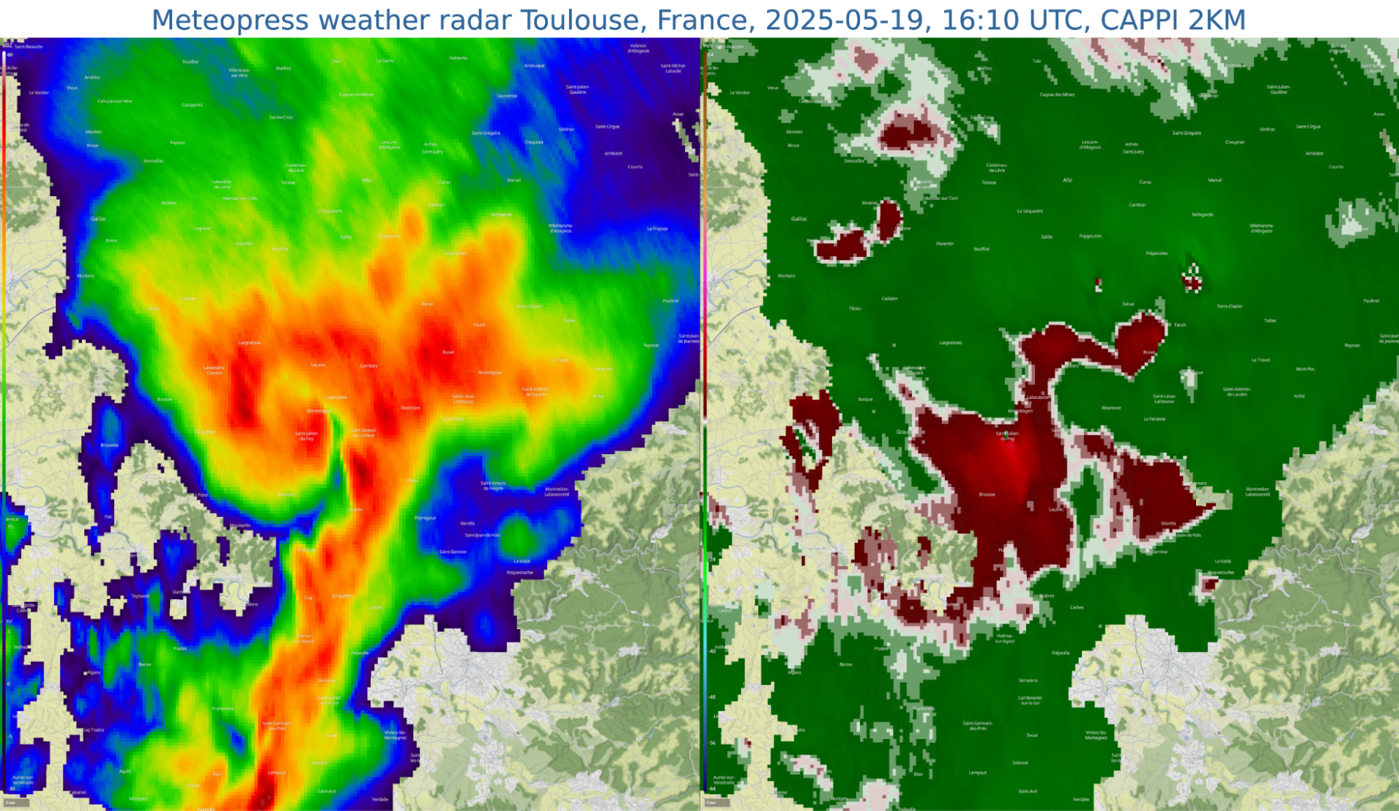
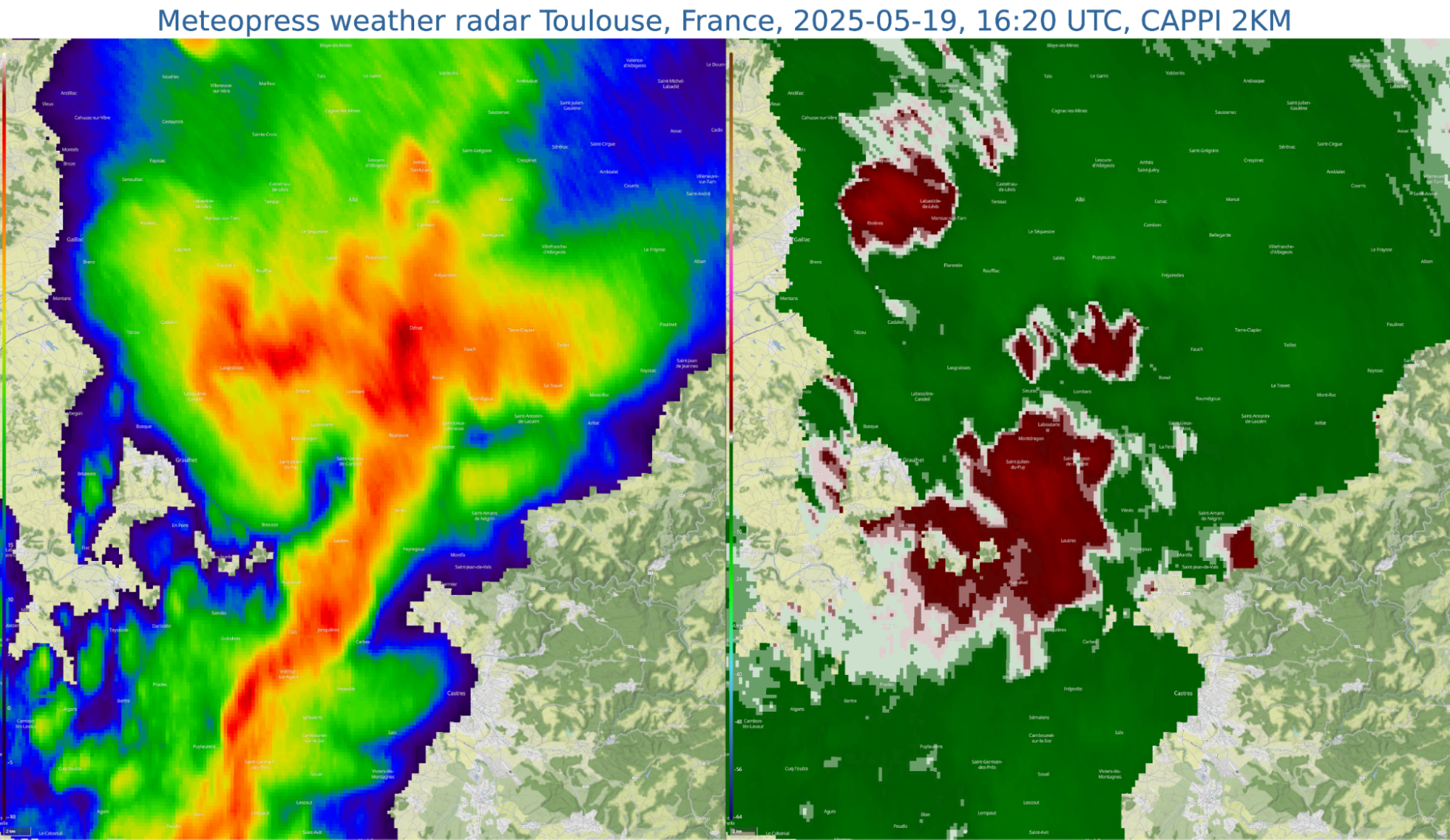
The supercell began to weaken after 16:00 UTC. During this phase, it continued to exhibit beautiful rotational features in Doppler velocity data. Radar reflectivity displayed a spiral-like structure, caused by precipitation wrapping around the decaying mesocyclone.
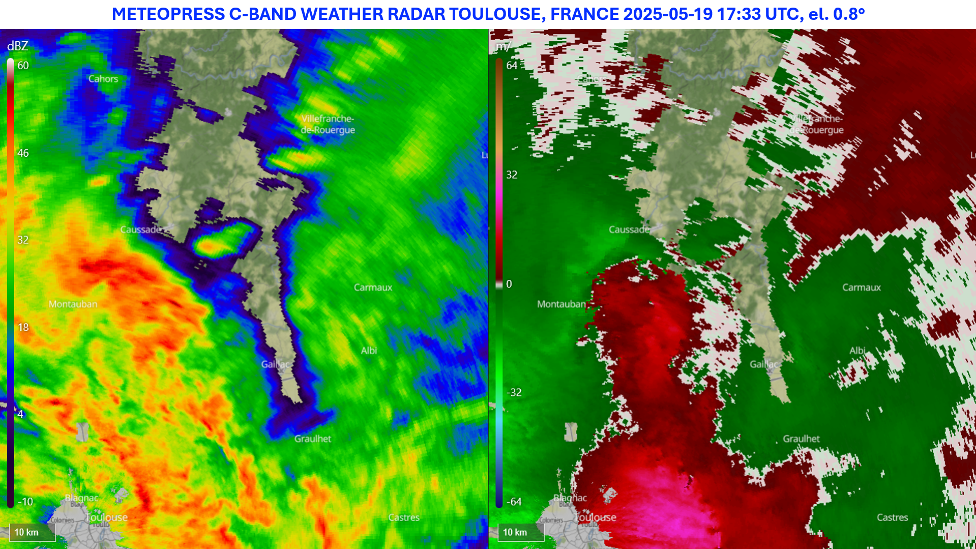
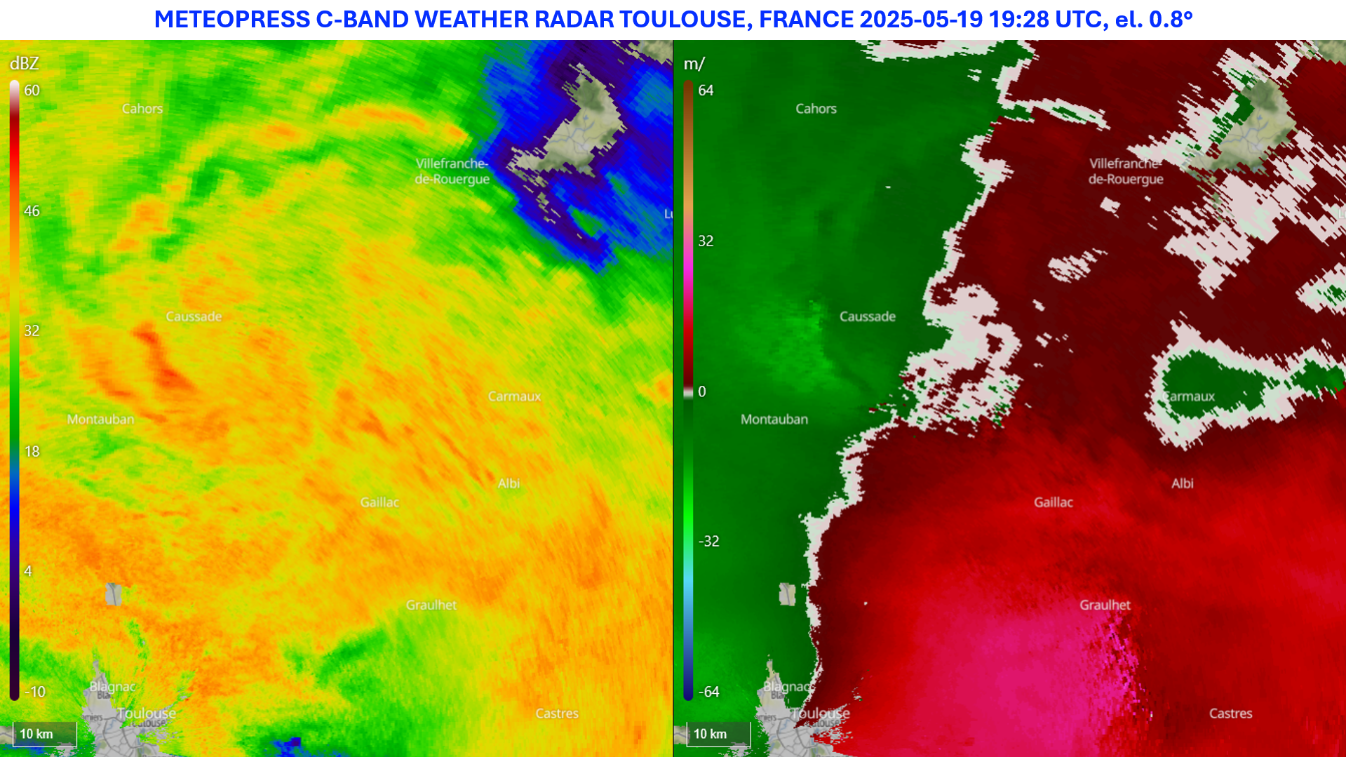
Meanwhile, more and more convective cells started to emerge around Toulouse. This led to the formation of a larger convective system that persisted into the evening. Between approximately 19:00 and 20:30 UTC, radar data revealed the development of a mesoscale convective vortex, with a clear rotational signature visible in Doppler velocity fields.
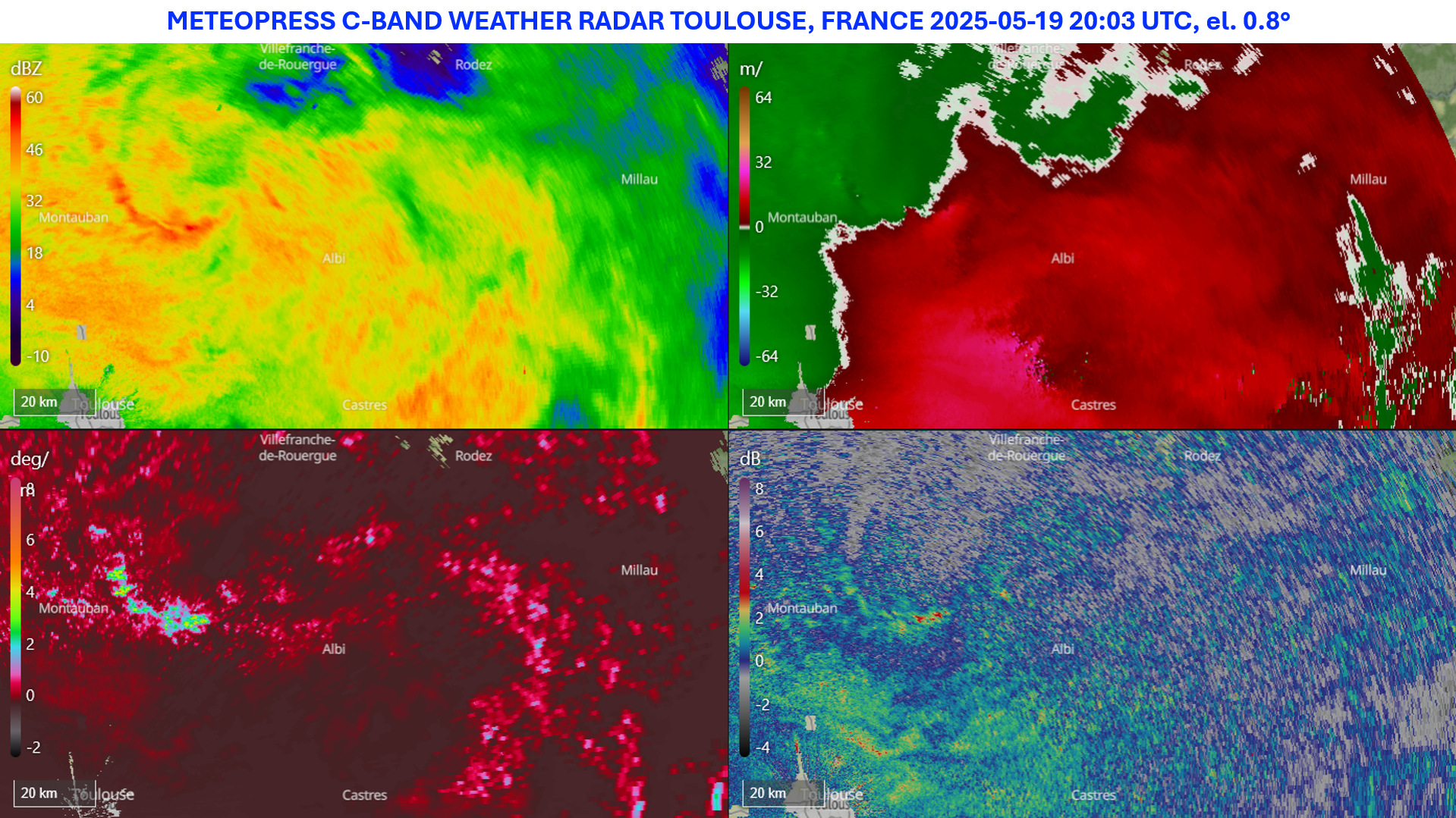
During the evolution of the MCV, more convection was observed in its rear sector, with updrafts evident in locally elevated values of differential reflectivity (ZDR). This rear sector also exhibited higher values of specific differential phase (KDP).
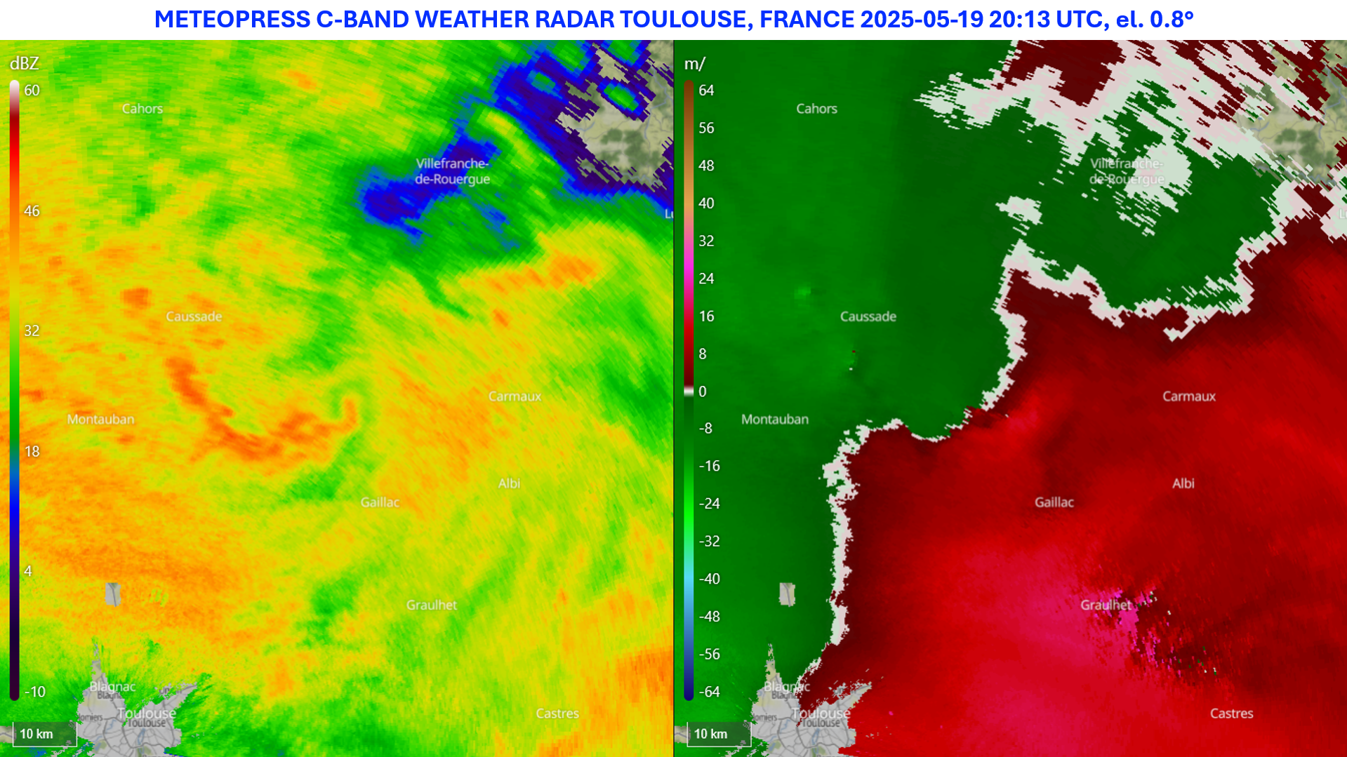
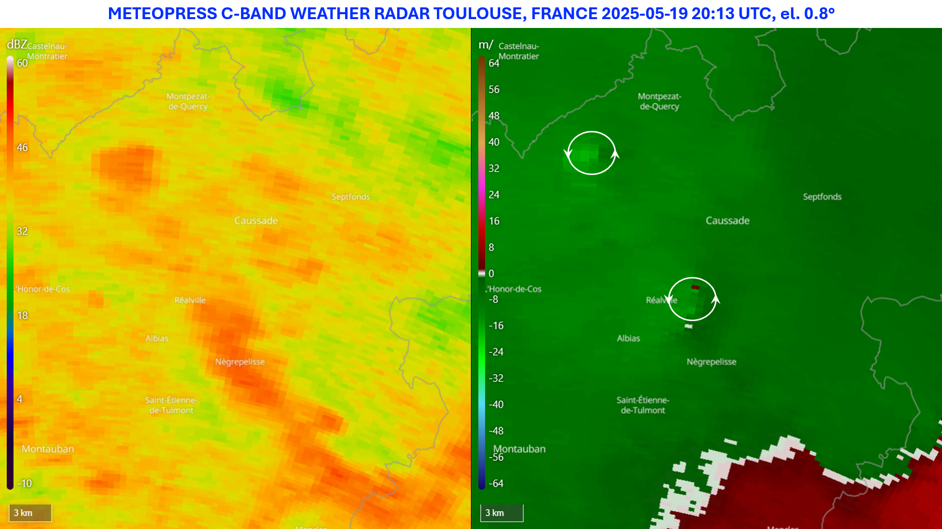
After some time, pronounced flow irregularities became visible in the same rear portion of the MCV, where convergence was occurring. This gradually led to the formation of two small mesovortices.
Case study - Supercells on 3rd May 2025
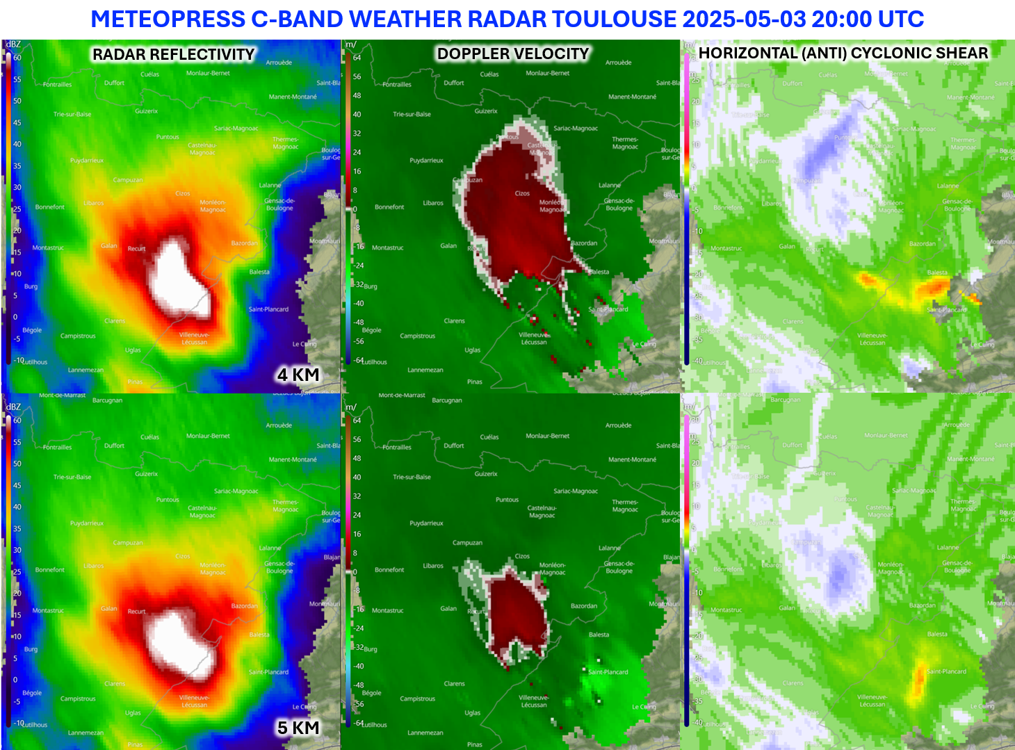
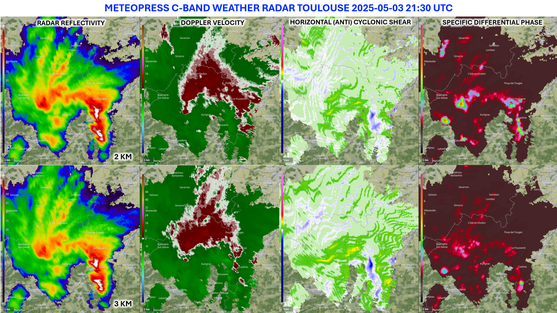
On 3rd May 2025, southern France was hit by several supercells with hail up to around 5 cm in diameter. Supercells showed beautiful rotation characteristics in Doppler velocity and Horizontal cyclonic shear.
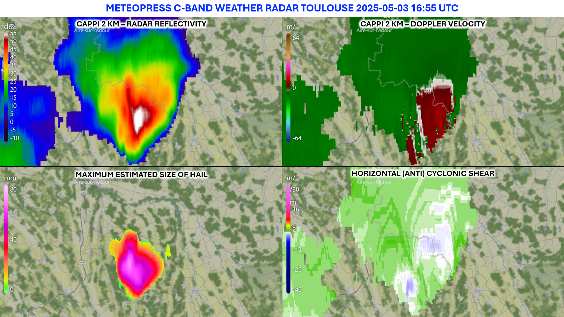
During the afternoon and evening, strong thunderstorms began to develop, most of which were supercells. These supercells were particularly notable for producing large hailstones, with diameters reaching up to 8 cm. Many of the supercells were characterized by maximum rotation occurring primarily in the mid-troposphere—around 5 km above the ground—while near-surface rotation was generally weaker. Stronger mid-level rotation typically supports the formation of larger hailstones, a trend confirmed by the MESH product, which estimated hail sizes of up to 6 cm within some of the supercells. As a result of the large hail, numerous hail spikes were also visible on radar imagery associated with the storms.
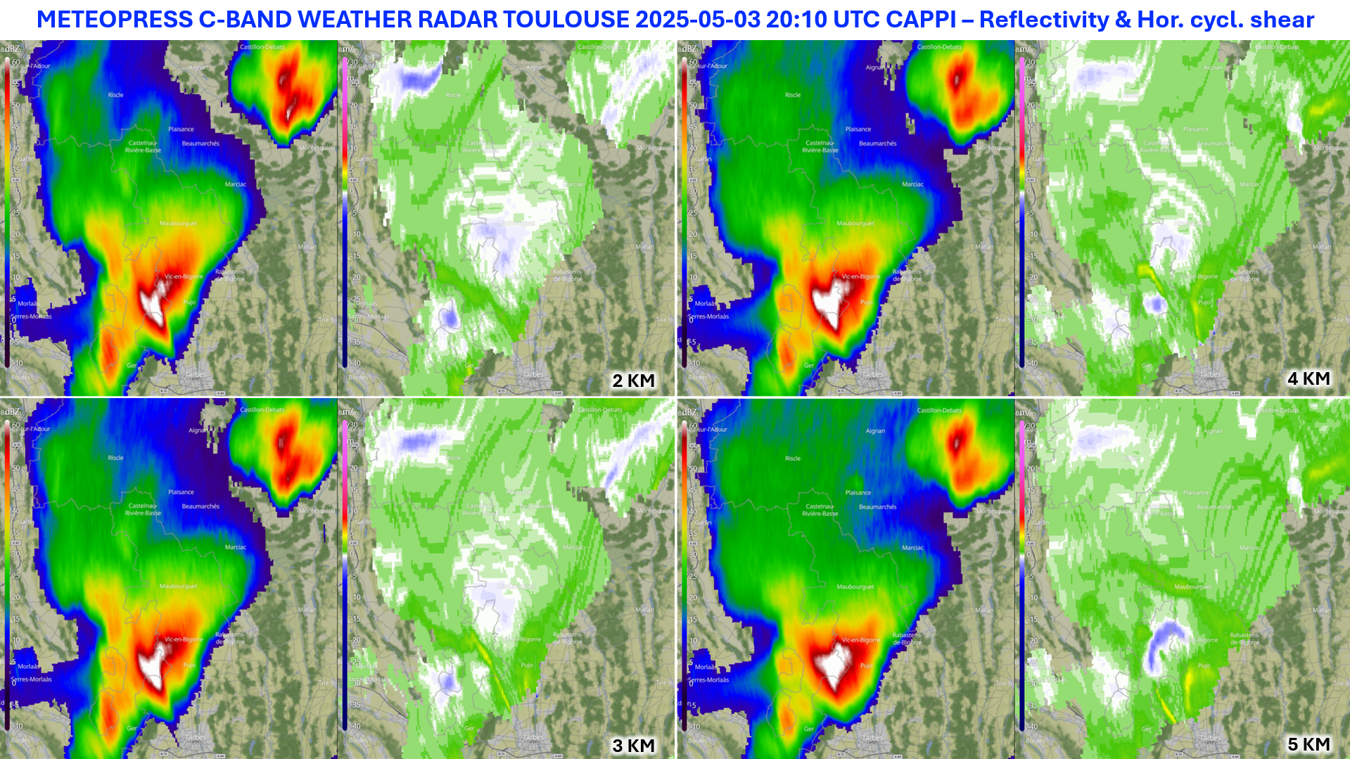
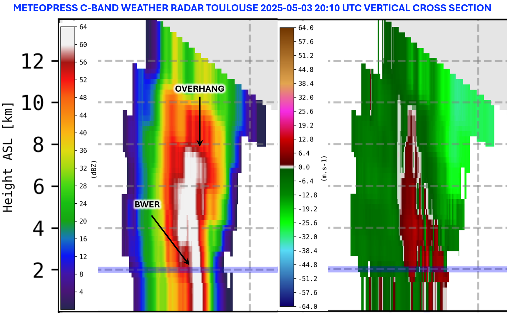
The supercells also exhibited well-defined vertical structures. A vertical cross-section of one of the storms shows a clear Bounded Weak Echo Region (BWER) on the reflectivity product, located in the inflow region, where radar reflectivity is notably lower. Reflectivity values exceeding 60 dBZ extending up to 8 km in altitude indicate a strong potential for large hail.
In the Doppler radial velocity cross-section, the strongest rotation is clearly concentrated in the mid-levels of the mesocyclone—between approximately 2 and 6 km altitude—while near-surface rotation is almost undetectable.
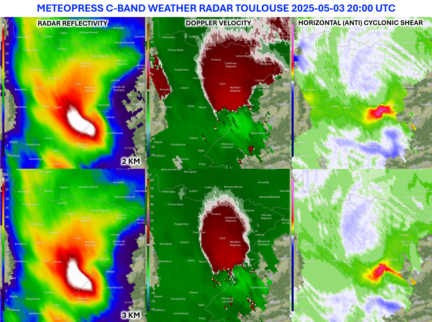
Interestingly, some supercells significantly intensified their rotation during the evening hours, including at lower altitudes around 2 km. This pronounced low-level rotation contributed to the well-defined structure of the storms, where classic features such as the Forward Flank Downdraft (FFD) and Rear Flank Downdraft (RFD) were clearly visible. One particularly strong supercell eventually evolved into a smaller squall line. As the original supercell weakened and dissipated, new storms—also supercells—began to form ahead of it, along the outflow boundary.
Case study - 25th June 2025
On 25th June, the atmospheric conditions were highly favorable for the development of strong supercells. Deep-layer wind shear reached 30 m/s, while CAPE values were around 2000 J/kg. The situation was further supported by significant helicity. As a result, several powerful supercells formed during the afternoon.
The first of these emerged in the foothills of the Pyrenees—an impressive pair of supercell "twins" that moved together toward the northeast. These storms were accompanied by large hailstones measuring approximately 6 to 7 cm in diameter. In addition to strong rotation observed by our radar—indicative of a well-developed mesocyclone capable of producing such large hail—the MESH product also suggested hailstones up to 8 cm in diameter. From a microphysical perspective, this is supported by low KDP (specific differential phase) values, which are typical of large hail.

Further confirmation comes from ZDR (differential reflectivity) data. Large hail typically shows low ZDR values, close to 0 dB, within hail cores. These are often surrounded by areas with higher ZDR values, corresponding to regions of melting hail or large raindrops.

Focusing on the vertical structure of the supercells, a striking Weak Echo Region (WER) can be observed, aligning with the vertical axis of rotation within the mesocyclone. Within the inflow region of warm air into the supercell, there are also notably lower RhoHV (correlation coefficient) values, further supporting the presence of large hail and intense storm dynamics.

Over time, the supercells merged, with the northern one showing strong mid-tropospheric rotation. This pronounced rotation persisted for several tens of minutes even as the storm began to weaken. However, based on other radar products (such as MESH), both supercells showed clear signs of weakening.

Eventually, as the supercells decayed, they produced a strong outflow boundary accompanied by a gust front. This boundary triggered the development of additional intense convective storms to the south and west of the radar. Remarkably, two well-structured supercells also formed as a result.

Sector blanking and beam blockage
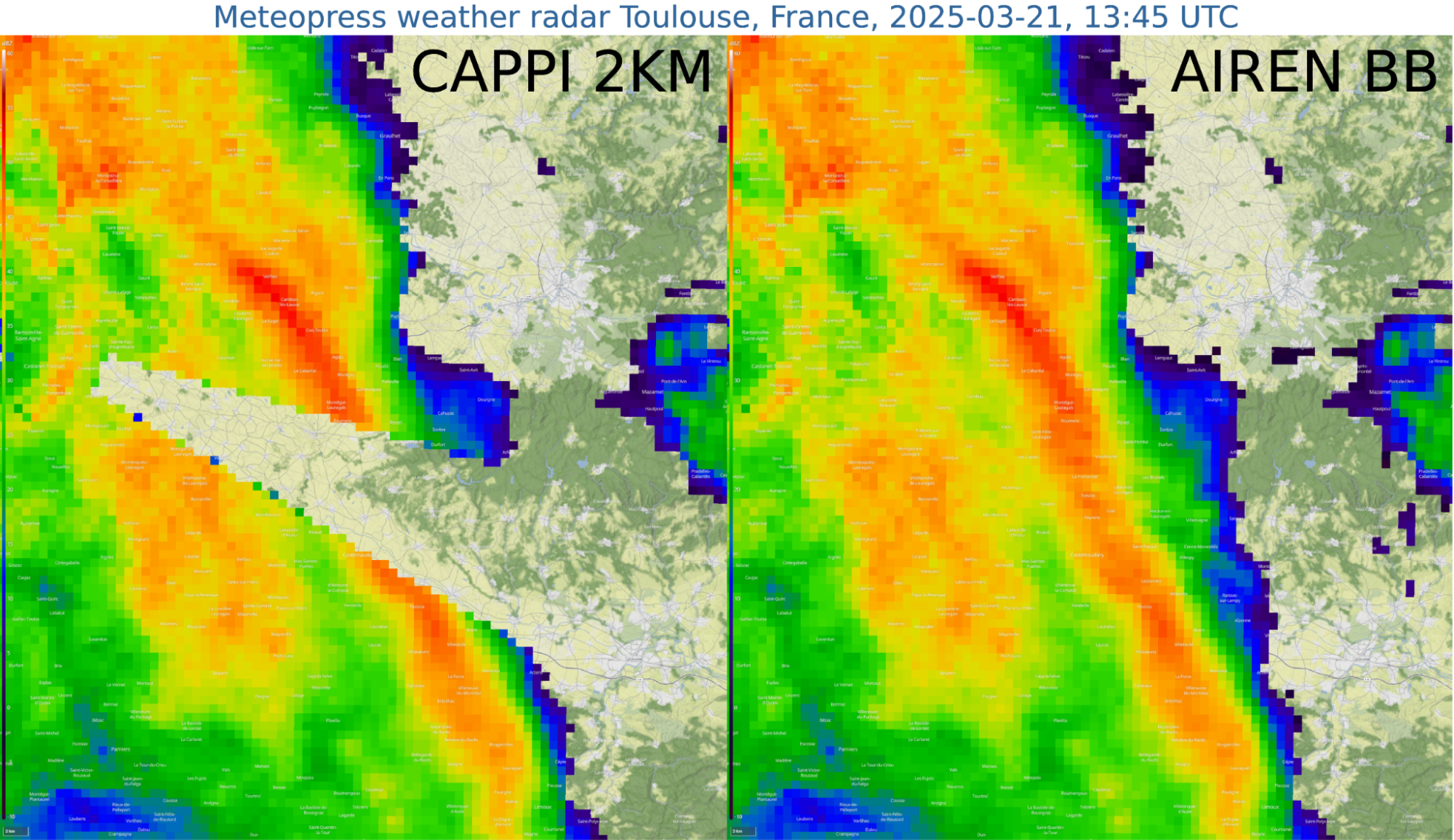
In Toulouse, Meteopress employs a technique known as sector blanking, where the radar deliberately avoids transmitting signals within specific azimuthal sectors. This is necessary because of another radar being nearby. While this creates gaps in the radar coverage, we are able to reconstruct the missing data using artificial intelligence. This product, called AIREN Beam Blockage, takes 2km CAPPI reflectivity data and fills the missing piece as shown in picture below.